
BASEMAP Hunting Maps and Mobile Mapping REVIEW
Basemap User Review
BaseMap is a navigation application for mobile devices that allows the user to download detailed maps for offline use when in the field. It is highly detailed and provides the user as much or as little freedom as they wish to have.
IN THIS REVIEW I’LL COVER THE FOLLOWING
Why I’ve Been Using BaseMap
Around the middle of the 2019 summer, I was contacted by the marketing team there at BaseMap to see if I’d be interested in trying out the platform. They gave me access to the PRO features and since that I’m I’ve been playing around with it getting to know the ins and outs throughout the summer and early hunting seasons. I was fortunate enough to have the founder of BaseMap, Jeff Balch, on my podcast to talk about the application, how it came about in the first place, and how he uses it. The idea there was to understand what was most important to the creator of this thing and how he implements it. It was an incredible interview and I came away with a ton of great advice on how to use a platform like BaseMap.
Prior to BaseMap reaching out, I hadn’t heard of it. Since I’m always curious about what’s out there and if it’s worth swapping over to, I decided to give it a go and find out for myself if it could outperform OnX or Gaia GPS (both of which are pretty standard mobile GPS applications).
So here are my thoughts after getting to know the company, the founder, and the application IN THE FIELD.
What is BaseMap
BaseMap is an application that runs on both your mobile phone and your desktop. When maps are downloaded to your phone via the application, your phone’s GPS can be used to show your exact location when you’re in the field and out of cell service. As with all of these applications, the GPS accuracy is pretty great and I’ve fully committed to using my phone as my handheld GPS solution. When pins, routes, or other information is created either in the mobile app or the desktop interface, data is automatically synced between devices. This is great for e-scouting or documenting a trip then pulling it up on your computer back home afterward.
BaseMap is a navigation tool you can use to get into the backcountry and out safely. It’s reliable and pretty straightforward.
The application is feature-rich and loaded with all kinds of tools depending on how much you want to nerd out. For my purposes, I’m mostly interested in trail systems, terrain features, hunting units, and being able to track where I’ve been. I personally don’t nerd out too much, but totally could if I wanted to.
Who is BaseMap for?
BaseMap is no doubt aimed at the hunting crowd. It is loaded with tons of features for e-scouting and can even help you find a specific hunting opportunity which is actually pretty cool. It can be a little complicated to navigate, but if you’re into that kind of thing, it’s pretty awesome.
We’ll go over a comparison of features in a later section.
What Makes BaseMap Different Than OnX or Gaia GPS
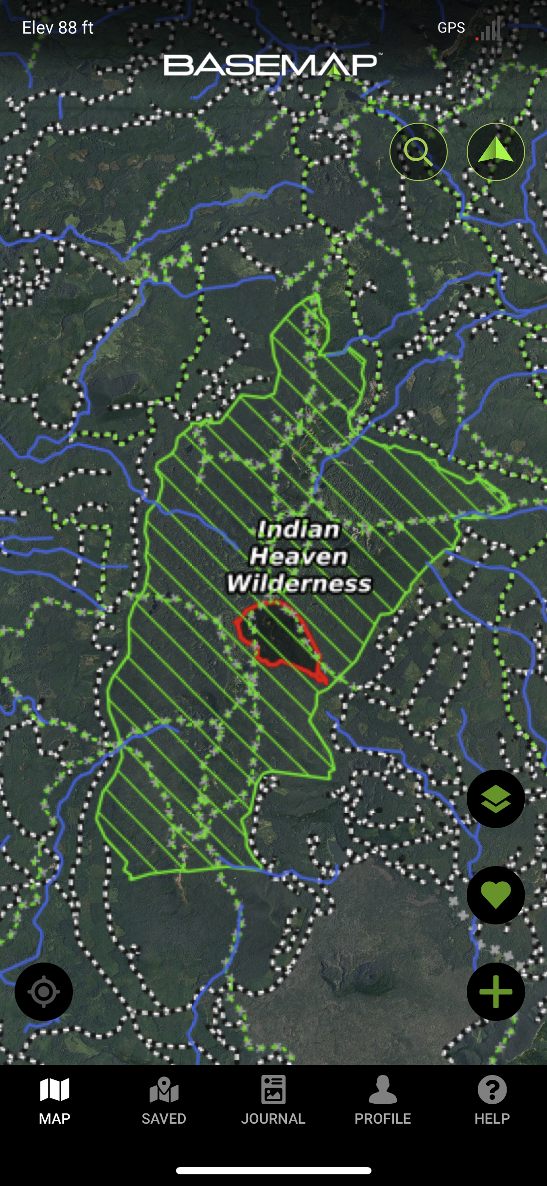
To me the thing that sticks out the most is this 3D terrain feature that you can use like you would Google Earth. Satellite images and topo lines don’t always tell the full story, but a 3D image can. You can look ahead at what’s coming up and have a much better idea of what to expect. If you’ve ever been cliffed out before in the field, you know this is a huge benefit.

I think the user interface is pretty nice once you get the hang of it. Each of these platforms has their own way of doing things, so you just have to learn how it works and you’ll be off and running.
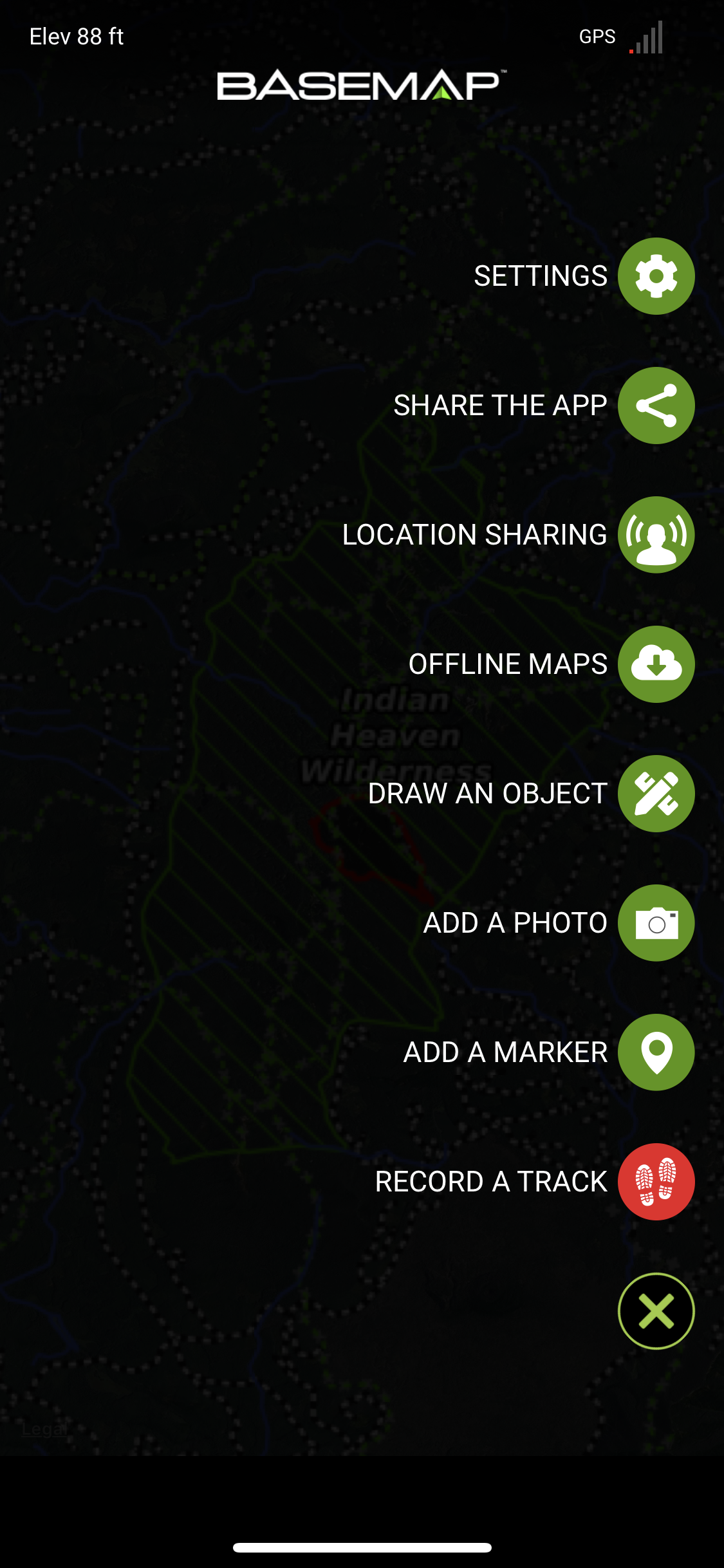
One of the biggest things I noticed and probably one of my favorite parts is an indicator in the top right of the application showing you GPS Signal strength. To my knowledge, none of the other apps I’ve used have this feature and if they did, I never noticed it. It’s just nice to know what’s going on when you open your app to find where in the world you are. I know it’s not ground breaking and it’s probably not something they even care to list as a feature, but I think it’s pretty dang sweet.
BaseMap Features and pricing
You’ll see there is Basic membership is FREE so you can download it and play around to see if BaseMap is something you enjoy. If you do enjoy it, I’d highly suggest upgrading to the PRO version because it allows you to use the application as it was originally intended. For 30 bucks a year, I’d say you can’t exactly offer up an excuse why you can’t pay that much considering that fancy drink you get at Starbucks now costs over $5 and when you take your girl on a date to McDonalds, you’ll be spending at least $15. To have maps and data readily available at your finger dips for such a low price is pretty amazing and you get what you pay for.
Don’t complain when the basic plan isn’t what you like when you’re getting it for free!

Things I like About BaseMap
Clean and Professional
I think the user interface is clean and professional. It doesn’t make you feel like someone smashed some data together and called it a day. Anytime a user interface is clean and professional, I immediately have a good experience. If it sucks and has bad icons or feels more like an engineer was at the wheel (sorry if you’re an engineer but you know what I mean…don’t act like you don’t), then I close it and never look back. BaseMap has a great look and feel to it. All you need to do is get used to where things are located.
GPS Strength
I’ll also mention again that I like the GPS signal indicator. You can see it clearly in the upper right-hand corner of the images below. It’s nice to know that when you have a bad signal so you don’t go making waypoints that end up being totally different. Seeing that signal strength also gives you confidence that the app is working. It’s a small thing and something you might not think of, but when you have it it’s nice.

Things I Don’t Like About BaseMap
It wouldn’t be an honest review or worth your time if I didn’t tell you the things I’m not a fan of, right? Before we dive in, I think it’s important to understand that anytime we don’t like something about a product, it’s could be because we aren’t using it how it was intended to be used. If you try to tow an RV with a compact car, you’ll probably get frustrated, right? But the reality is that car wasn’t made to tow an RV. The same goes for gear and applications. Not everything is made for you and your specific purpose. Once you finally realize that, you won’t have such a bad attitude about gear that doesn’t work for you. That said, there IS bad stuff out there, but BASEMAP is not one of those.
Route Making
The biggest sore for me, and it’s the reason I ditched OnX as well, is that you can’t make routes on top of existing trail systems unless you do the tedious work yourself. All you can do is drop waypoint after waypoint after waypoint along a known trail system in order to get some idea of the distance between two locations via a trail system. This is a highly inaccurate and inefficient way of doing things. If I didn’t have experience with GAIA GPS, I wouldn’t know I was missing with OnX or BaseMap. The way GAIA works is you drop a pin at one location on a trail and another pin at whatever distance you want further down that same trail or in some other vicinity (just drop it close to a trail) and the software snaps a route along the trail system like magic (see below images for an example). It picks the fastest route from point A to point B for you so you don’t have to. It’s like regular mapping software for when you’re driving. It gives you the route and you can adjust it if you need to.
Both OnX and BaseMap don’t have this feature and it’s the reason why I’ll likely never fully make the jump to either platform. Accurate knowledge of trail distances is huge because that’s how we travel the backcountry. Even if you’re hunting off-trail, you’ll likely use some trail to get to where you’re jumping into the unknown. You’ll do your best to estimate distance and depending on how far you’re going, you can risk being off by literal miles. For some, it’s not a deal-breaker, but for me, it is because I know what I’d be missing out on.
I don’t think it would be a huge upgrade to allow routes to be magically laid on top of existing trail data without manually inputting it because the GPS points are already there. Someone else is already doing it so it’s not a stretch of the imagination to make it happen.
Below are images of the GAIA GPS interface with routes made. You can see how they are directly over the path of a trail (that link has a discount code if you’re interested in giving it a go).


Finding What You Need
I’ve been using the BaseMap application for a number of trips now and I still find myself lost in it at times. This isn’t a huge deal-breaker for me because each application we use has a different method of doing things, but for some reason, it’s just not intuitive for me. I have to think about what I want and decode where it might be listed. Flipping through map layers can be a little overwhelming because the layer you’re looking for might be a few layers deep somewhere.
When I’m in the field, I want access to multiple layers and I want them quickly. So far, I just haven’t been able to get there yet with BaseMap. It might just be me and the way my mind works not fitting well with how it was designed so you might have a totally different experience. If it was the only application I was running I’m sure I’d get used to it, but I’m not so it continues to give me a little trouble when I’m trying to pull up the information I need.
Final Thoughts On Using Basemap for Backcountry Navigation
So what’s my final verdict? I think it’s a great option if you’re looking for a platform to use that turns your phone into a handheld GPS. It’s still fairly young so like anything, it’ll continue to get better and better.
I can’t find anything about it that makes it a “bad” option. It’s very similar to OnX so most of what it provides, BaseMap does too. The thing that makes it different to me is the 3D imaging. It’s a nice feature, but it takes some getting used to. It doesn’t have the fidelity of Google Earth, but it’s still nice.
BaseMap has been around for a number of years now and has a solid team behind it that continually works to improve it. The Founder of BaseMap is the kind of guy you can have a long-lasting conversation with and from what I can tell he has the right values. He built this application because it’s what he needed in one. The market didn’t offer the solution he wanted so he made his own and it really is a great platform. If you ask me, I’d much rather spend my money on a platform that is run by a solid team with the right values than one that isn’t. From what I can tell, Jeff is doing what he’s meant to do and puts in the hard work and effort to make things the best they can be.
For me however, the inability to utilize trail systems for building easy routes is the thing that prevents me from jumping ship from GAIA. It’s the reason I left OnX and it’s the reason I’ll stay away from any other platform that doesn’t give me the same features. I personally can’t live without it, but that’s me.
Discount Code
If you want to give BaseMap a try, you can use the code ByLand19 for 10% off your purchase. I do receive a minor kickback for you signing up with it, so I’d appreciate any purchases, but you don’t have to use it. It’s there if you like. I think if you’re looking for an application for your mobile phone, BaseMap is worth giving a go! You never know until you try it.
You might wonder why I’m offering a code for a product I’m not using all the time. Great question. I’m in the business of helping YOU have a good experience, not me. If you log in to BaseMap and find it to be what you’re looking for, I want you to use it! We all have preferences so I’m not going to NOT offer a discount to you just because I’m personally not a dedicated user. If I know it’s a solid product even if I know it’s not for me, I think it’s still worth helping others by getting them a discount when possible.
Thanks for reading this review!